Small dimensional changes can matter
Draft, beam, air draft or LOA changes may alter access to a preferred cruising programme or home-port infrastructure.
PORT DATA FOR YACHT DESIGN
LOA, beam, draft, air draft and utility decisions shape the set of harbours a yacht can plausibly use. MaritimIQ gives designers and technical teams a structured way to explore those consequences across real harbour evidence—without treating incomplete global data as a design rule or safe-navigation assessment.
Explore how dimensional scenarios change recorded harbour compatibility.
Identify which constraints are authoritative, contextual, conflicting or not yet evidenced.
Give owners a clearer explanation of operational trade-offs during design and refit decisions.
WHY THIS ROLE NEEDS IT
Describe, compare and plan the physical and service environment that yachts depend on.
Draft, beam, air draft or LOA changes may alter access to a preferred cruising programme or home-port infrastructure.
Contextual bathymetry, directory values and official controlling depths cannot be treated as interchangeable.
A missing restriction does not prove unrestricted access; it may only reveal a coverage gap requiring specialist verification.
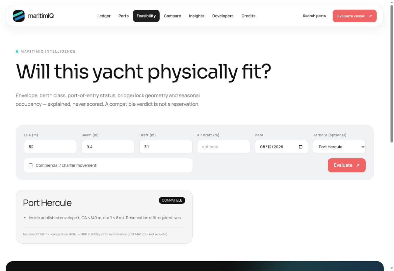
Vessel-to-harbour feasibility
Change the yacht envelope and inspect why the harbour result changes—or why evidence is insufficient.
ROLE-SPECIFIC FEATURES
Test design scenarios against supported LOA, beam, draft, air-draft and infrastructure constraints.
Keep depth type, vertical datum, observation and source class attached to every relevant value.
Inspect recorded entrances, channels, locks, bridges and breakwater context without generating a route-to-go.
Compare shore-power and water specifications with the yacht's intended systems and operating profile.
Show owners which preferred destinations are supported, constrained or simply insufficiently evidenced for the scenario.
USE CASES
Compare several LOA or draft scenarios against a selected set of owner-priority ports.
Evaluate whether a modification to draft, appendages or power requirements changes recorded compatibility.
Prepare a candidate port list for detailed route, chart, pilotage and operator review before handover.
COMMERCIAL API ACCESS
Use the API in design studies, digital twins or owner portals to run repeatable compatibility scenarios. Responses retain evidence quality so models can separate a known limit from an absent fact.
/v1/compatibilityEvaluate dimensional design scenarios against harbour evidence.
/v1/harbors/:id/hydrographyRetrieve typed depths, datums and supporting observations.
/v1/harbors/:id/approachesInspect recorded approach-channel and restriction context.
/v1/harbors/:id/utilitiesCompare shore-side utility specifications.
Bearer keys, plan-aware limits and explicit scopes apply. API output is decision support—not a navigational chart, safety approval or live berth reservation.
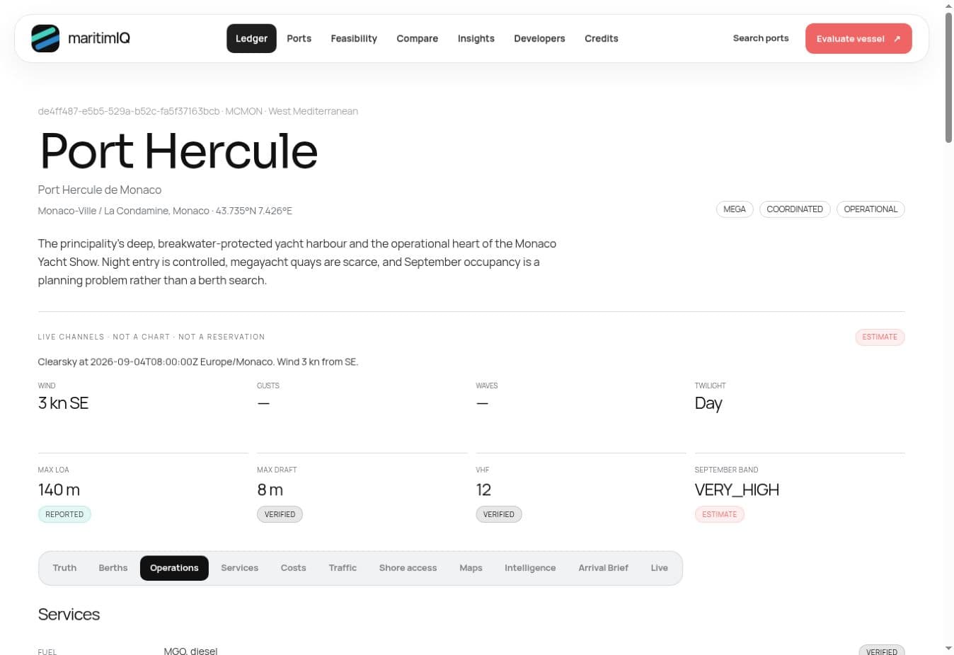
Port Hercule intelligence dossier
The harbour dossier keeps reported dimensions, confidence and live context visibly separate.
A PRACTICAL WORKFLOW
Define the yacht scenario and the ports important to the owner profile.
Run the same scenario across evidence-backed harbour constraints and review gaps.
Move material assumptions into formal naval, class, hydrographic and operator diligence.
TRUST MODEL
Decision-critical facts keep their source, observed date, confidence and conflict state.
Missing evidence is never quietly translated into no, zero, available or safe.
Accessible source material and permitted redistribution remain separate decisions.
QUESTIONS
No. It is an early-stage intelligence input. Class, flag, yard engineering, official hydrography and competent authorities control design and operational approval.
No. It exposes harbour and approach evidence for decision support and does not generate an official route, chart or safety clearance.
They remain UNKNOWN or produce INSUFFICIENT_DATA. The platform does not infer unrestricted access from an empty field.
RELATED SOLUTIONS